
Garmin GPSMAP 79sc
4.0Editor score
Floating water-resistant handheld design
Preloaded BlueChart g3 coastal charts
Multi-constellation satellite tracking
Compass and barometric altimeter
Marine GPS units combine navigation, mapping, and often sonar into a central command for safe movement on the water. A useful model should deliver readable charts, dependable positioning, a screen suited to the vessel, and connectivity or networking options that complement the equipment already aboard.
The products in this guide were compared using the information supplied for each listing, including mapping coverage, display size, sonar functions, connectivity, ruggedness, and intended boating environment. The list covers multifunction displays, chartplotters, marine handhelds, and a basic handheld navigator, giving readers a broad set of options.
Each review explains the standout features, practical limitations, and likely buyer profile of the individual model. Ratings and availability can change over time, and marine electronics are often offered in different configurations, so shoppers should confirm the included transducer, mapping, radar, and networking options before buying.
4.0Editor score

4.7Editor score

As an Amazon Associate we earn from qualifying purchases.
This side-by-side comparison highlights the differences in screen size, mapping, sonar, connectivity, and physical design, helping boaters match each unit to their vessel and navigation priorities.



The Simrad GO Chartplotter and Fish Finder combines GPS navigation, sonar support, radar capability, and broad connectivity in a multifunction display aimed at sportboats, center-consoles, and smaller cruisers. Its 4.4 rating reflects a capable general-purpose package, while the included C-MAP Discover card adds meaningful mapping value at the time of purchase.
We may earn a commission when you buy through this link, at no additional cost to you.
The standout feature is the combination of navigation and fish-finding functions. The listing calls for HDI transducer support with 83/200 kHz operation, clear CHIRP sonar, and DownScan Imaging, giving users more ways to inspect bottom structure and fish targets. Built-in GPS, Wi-Fi, and NMEA 2000 also make it possible to integrate additional marine equipment and mirror information to a compatible phone or tablet.
C-MAP Discover supplies full-featured vector charts, custom depth shading, tides and currents, bathymetric contours, and broad United States and Canadian coverage. Radar is presented as an option rather than a guaranteed included component, and the listing does not provide a precise screen size in the supplied details. Buyers should therefore confirm the exact GO display configuration, transducer packaging, and radar hardware before ordering.
This is a strong recommendation for boaters who want one flexible command center rather than several isolated devices. It is especially appealing when a boat already uses NMEA 2000 equipment or when future radar and sonar expansion is likely. Those wanting the simplest possible interface may prefer a more specialized model, but the Simrad remains a well-rounded option for integrated marine electronics.
The combination of GPS navigation, CHIRP sonar, DownScan Imaging, and optional radar allows the display to serve both route-finding and fish-location tasks. That versatility can simplify equipment planning for smaller boats and cruisers.
C-MAP Discover adds depth shading, tide and current information, bathymetric contours, and extensive United States and Canadian coverage. These details can help boaters interpret unfamiliar water beyond simple shoreline boundaries.
We may earn a commission when you buy through this link, at no additional cost to you.
The Garmin ECHOMAP UHD2 94sv is a well-balanced nine-inch chartplotter with a 4.7 rating and one of the most complete standard packages in this guide. Its bright, sunlight-readable touchscreen is designed for improved detail, clarity, and viewing angles, making it a practical central display for a wide variety of coastal and inland boating situations.
We may earn a commission when you buy through this link, at no additional cost to you.
The included GT56-TM transducer supports Garmin traditional, ClearVü, and SideVü scanning sonar, so the package is ready for multiple approaches below the surface. Garmin Navionics+ U.S. coastal charts are preloaded, and built-in Wi-Fi can share sonar, waypoints, and routes with another compatible ECHOMAP UHD2 chartplotter. The unit also connects wirelessly to a Force trolling motor for route following, waypoint navigation, speed control, and battery checks.
The main limitation is regional chart coverage. Navionics+ U.S. coastal mapping is appropriate for many boating areas, but it may not provide the same coastal detail for every international destination. Radar is not identified as included, and the supplied information does not indicate a separate radar option. Owners seeking a complete offshore command system may need additional compatible hardware.
For most buyers, this is the most straightforward all-in-one choice in the roundup. The screen, transducer, charts, wireless functions, and trolling motor integration cover the needs of many modern anglers and cruisers without requiring a complex initial setup. Choose it when readability, complete sonar capability, and straightforward connectivity matter most.
A sunlight-readable nine-inch touchscreen is especially useful on open water, where glare and changing light can make smaller screens difficult to interpret. Improved clarity and viewing angles also help when the unit is used by more than one person.
Wi-Fi sharing lets compatible ECHOMAP UHD2 units exchange sonar, waypoints, and routes. Force trolling motor integration adds route following, speed control, and battery-status information without relying on a separate physical controller.
We may earn a commission when you buy through this link, at no additional cost to you.
The Garmin GPSMAP 943xsv SideVü is a high-end chartplotter for boaters who prioritize advanced sonar and a polished display. Its 4.7 rating places it among the strongest-rated products here, while the supplied listing highlights ultra high-definition scanning sonar, Panoptix support, preloaded mapping, and improved display optics.
We may earn a commission when you buy through this link, at no additional cost to you.
The SideVü focus makes this display appealing to anglers and skippers who want a clear view of structures beside the boat. Panoptix sonar support broadens the available visualization options, while preloaded mapping reduces the need to configure basic navigation immediately after installation. Improved optics are particularly valuable on bright days and in glare-prone cockpit environments.
The supplied product information is concise, so buyers should verify whether a transducer is included, which mapping license is preloaded, and what radar or network accessories are compatible. The model name identifies SideVü, but it belongs to a broader ecosystem that may be configured for additional sonar, engine data, and external devices. Those details can materially affect the final setup.
The GPSMAP 943xsv is a strong fit for performance-oriented anglers and serious boaters who want more advanced sonar visualization than a basic mapping display can provide. It is less compelling for casual users who only need a simple route line and local coastal chart, but its rating, mapping, and Panoptix support make it a compelling premium-class chartplotter.
Ultra high-definition scanning sonar and SideVü provide a more detailed view of the water column and submerged structure. Panoptix support provides another avenue for expanded sonar visualization when the appropriate compatible hardware is used.
Improved display optics are important for a permanent helm installation. A clearer image can reduce eye strain and make critical markers, routes, and sonar returns easier to interpret during long days on the water.
We may earn a commission when you buy through this link, at no additional cost to you.
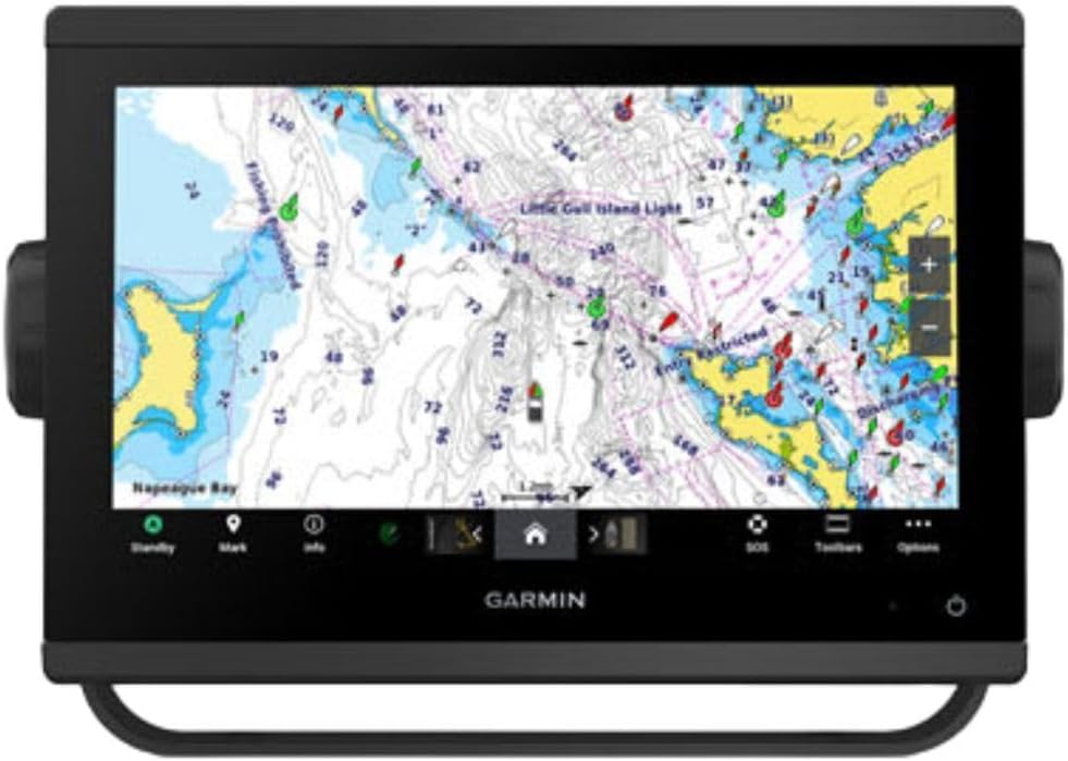
The Garmin GPSMAP 1243xsv with GMR 18 HD3 Radome is the most complete premium helm package in this roundup. It combines a large chartplotter with included radar hardware, extensive network capability, engine compatibility, and OneHelm digital switching, making it aimed at serious boat builders and owners of complex marine systems.
We may earn a commission when you buy through this link, at no additional cost to you.
The included GMR 18 HD3 radome is the defining feature. Radar contributes target awareness around the boat, while the chartplotter provides preloaded Garmin Navionics+ charts and a central display for route and vessel information. Third-party device connectivity and superior network connectivity create a foundation that can expand as more instruments, sensors, and controls are added.
This is not a simple drop-in handheld or a compact unit intended for a first modest chartplotter. The listing points to engine compatibility, digital switching, remote control, and a permanent multi-function display, all of which can require careful mounting, power, data connections, and configuration. The supplied information also provides no current customer rating, so buyer confidence must come more from the specified feature set than from aggregated feedback.
The Garmin GPSMAP 1243xsv is best suited to larger boats, serious offshore anglers, and owners building a networked helm. It is a particularly compelling choice when a radar unit is already desired, because the listing identifies the GMR 18 HD3 radome as part of the package. Confirm installation requirements and network compatibility before finalizing the purchase.
The included GMR 18 HD3 radome removes the need to source a separate compatible radar for the core package. It expands the unit's role from navigation display to a broader situational-awareness system.
OneHelm digital switching, third-party device connections, and network support allow the display to serve as the center of a larger onboard electronics system. That scalability is valuable for owners planning future engine, autopilot, and instrument upgrades.
We may earn a commission when you buy through this link, at no additional cost to you.
The Garmin GPSMAP 79sc is a durable, floating marine handheld for anglers, kayakers, and small-boat skippers who need reliable navigation away from a permanent console. Its 4.0 rating is the lowest among the rated products in this guide, but the physical design, chart inclusion, and navigation memory make it a compelling specialized option.
We may earn a commission when you buy through this link, at no additional cost to you.
The unit is water-resistant to IPX6 at the unit level, designed to float, and protected by scratch-resistant fogproof glass. Preloaded BlueChart g3 coastal charts remove an initial mapping hurdle, while support for GPS, GLONASS, Beidou, Galileo, QZSS, and SBAS helps maintain tracking across a broad range of satellite systems.
Storage is generous for a handheld, with capacity for 10,000 waypoints, 250 routes, and 300 fitness activities. A three-axis tilt-compensated electronic compass displays heading even while stationary, and the barometric altimeter tracks pressure-related altitude changes. Battery life reaches up to 20 hours in GPS mode, which is useful for full-day excursions.
This is an excellent backup or primary navigator for a smaller craft, especially where a fixed display would be impractical. It does not offer fish-finding sonar, and its compact screen cannot provide the detailed chart workspace of a 9-, 10-, or 12-inch multifunction display. Nevertheless, the floating construction, coastal charts, and extensive storage make it a standout handheld choice.
A floating, water-resistant body helps protect navigation if the handheld is dropped overboard or used around a wet cockpit. Fogproof, scratch-resistant glass also suits the repeated handling expected of portable electronics.
The handheld format works particularly well for kayaks, personal watercraft, and compact boats where console installation is impractical. Preloaded coastal charts and a 20-hour GPS runtime support extended days away from shore.
We may earn a commission when you buy through this link, at no additional cost to you.
The Garmin GPSMAP 79s is a rugged floating handheld built for navigation across widely varied regions. It carries a 4.2 rating and shares the GPSMAP 79 series' durable construction, generous memory, electronic compass, and long battery life, while its worldwide basemap is the primary distinction from the coastal-chart version.
We may earn a commission when you buy through this link, at no additional cost to you.
The worldwide basemap is useful for international travel or exploration of inland waterways because it provides a broad geographic foundation before more detailed charts are added. The handheld supports GPS, GLONASS, Beidou, Galileo, QZSS, and SBAS, allowing it to use several satellite constellations for tracking reliability. It also stores up to 10,000 waypoints, 250 routes, and 300 fit activities.
Compared with the GPSMAP 79sc, the key consideration is chart detail. A worldwide basemap helps a user understand coastlines and land features, but it is not the same as a full coastal chart with the same navigation detail. The unit also lacks sonar, so it should be viewed as a navigator rather than a fish finder or full helm system.
Buyers who visit changing regions and want one rugged portable device should give the GPSMAP 79s serious consideration. It is a natural choice for international sailors, remote anglers, and emergency equipment lists. For detailed U.S. coastal work, the 79sc may be a more logical starting point because its chart package is tailored to that purpose.
A worldwide basemap gives the unit useful geographic context far beyond a single country. It is a practical starting point for travelers who may move between coastal regions, lakes, and rivers during the same ownership period.
Support for several satellite constellations can improve positioning options in challenging outdoor environments. The three-axis electronic compass and barometric altimeter further expand the unit's usefulness away from a fixed helm.
We may earn a commission when you buy through this link, at no additional cost to you.
The Garmin GPSMAP 1022xsv is a ten-inch combo chartplotter with a 4.7 rating, combining a large fixed display with a fish-finding-capable architecture. The key configuration detail is that it does not include a transducer, making it most appropriate for boaters who already own compatible sonar equipment or prefer to select that hardware separately.
We may earn a commission when you buy through this link, at no additional cost to you.
A ten-inch screen offers more room for charts, routes, sonar data, and instrument panels than a compact chartplotter. This is valuable at a permanent helm, particularly on larger vessels where navigation information may be viewed from more than one position. The product is identified as a combo unit, so it is intended to handle both navigation and sonar when a suitable transducer is installed.
The absence of an included transducer is the central trade-off. Buyers starting from scratch need to budget for a compatible sensor, mounting hardware, cable routing, and installation, whereas the ECHOMAP UHD2 94sv includes a GT56-TM unit. The supplied product details are limited, so chart coverage, networking, and exact sonar capabilities should also be confirmed with the seller before ordering.
Despite that configuration caveat, the GPSMAP 1022xsv is a solid choice for an established helm that needs a large display. It is particularly attractive to owners of compatible boats with existing transducer wiring or a preferred sonar package. For a first-time chartplotter purchase, the missing transducer makes a bundled alternative easier to justify.
The ten-inch screen gives route, chart, and sonar views more working space than portable or compact units. That extra room is useful on a console where navigation information remains visible alongside other instruments.
Because the bundle omits a transducer, owners can use a compatible sensor already installed on the boat or select one based on their preferred sonar technology. This flexibility also means installation and hardware costs must be considered separately.
We may earn a commission when you buy through this link, at no additional cost to you.
The Garmin GPS 76 is a basic handheld GPS navigator that emphasizes straightforward positioning over modern multifunction features. Its 4.6 rating indicates strong customer satisfaction for the device's core purpose, while its WAAS-enabled receiver and ability to track as many as 12 satellites provide a dependable foundation for route navigation.
We may earn a commission when you buy through this link, at no additional cost to you.
The trip computer displays current speed, average speed, a timer, and trip distance, making it useful for basic journey information. One megabyte of memory supports downloaded data from optional Garmin MapSource CD-ROMs. Two AA alkaline batteries provide up to 16 hours of use, which gives the unit a simple and familiar power system.
The limitations are substantial compared with the chartplotters and marine handhelds elsewhere in this guide. Its one-megabyte memory is minimal by current standards, and it does not list detailed marine charts, Wi-Fi, Bluetooth, NMEA networking, sonar, or a modern touch interface. The supplied information also does not confirm a floating or water-resistant design, so it is less obviously suited to wet marine use.
The GPS 76 makes sense as an inexpensive emergency navigator, hiking or travel backup, or simple onboard reference device. It is not the leading choice for detailed coastal navigation or a multifunction helm. Its value lies in uncomplicated operation, portable size, and long battery life rather than in chart sophistication or integration.
The receiver continuously tracks satellites and uses WAAS corrections, focusing on reliable positioning without the distractions of a complex chartplotter interface. That simplicity can be valuable during an emergency or on an uncluttered trip.
Current and average speed, elapsed timing, and trip distance cover the most common journey statistics. The AA battery configuration also makes it easy to keep spare cells available.
We may earn a commission when you buy through this link, at no additional cost to you.
The Garmin GPSMAP 1223xsv is a feature-rich 12-inch combo unit that earned a 5.0 rating in the supplied product data. Its large IPS touchscreen, built-in traditional CHIRP, ClearVü, and SideVü sonar, worldwide basemap, and extensive networking make it a strong candidate for a sophisticated permanent helm.
We may earn a commission when you buy through this link, at no additional cost to you.
The IPS panel is designed to remain bright, clear, and easy to read in all conditions, including direct sunlight. Below the surface, the 5,000-watt traditional CHIRP system offers target separation and clarity, while ClearVü and SideVü provide broader scanning views. Together, those technologies give the unit a well-rounded fish-finding package without requiring a separate display.
Connectivity is a major strength. J1939 allows links to compatible engines and devices, while NMEA 2000 and NMEA 0183 networking can connect autopilots, VHF radios, AIS transponders, and other marine electronics. Wi-Fi and Bluetooth support smartphone or tablet connections, chart viewing, software updates, and data sharing. Optional BlueChart g3 Vision charts and compatible Garmin radar can add further detail and situational awareness.
This model is best for serious anglers and owners of electronics-heavy boats who can justify the large permanent display. A 12-inch unit requires enough console space and appropriate mounting, and the radar is not part of the specified package. Even with those considerations, the combination of a perfect rating, strong sonar, excellent display, and broad networking makes it one of the most capable products in the guide.
The 12-inch IPS display provides abundant screen space and remains readable in direct sunlight. It is particularly useful for skippers who want charts, sonar returns, routes, and instrument data visible together in a permanent installation.
Traditional CHIRP, ClearVü, and SideVü cover complementary views of fish targets and bottom structure. This gives the unit flexibility across fishing conditions while avoiding a single-sonar approach.
J1939, NMEA 2000, NMEA 0183, Wi-Fi, and Bluetooth create extensive paths for engine data, radios, autopilots, AIS, mobile devices, and software updates. The result is a central platform for a complex marine electronics setup.
We may earn a commission when you buy through this link, at no additional cost to you.
The Garmin GPSMAP 743 is a seven-inch mapping display that received a 5.0 rating in the supplied data. It is designed as a navigation-focused unit without built-in sonar, making it an interesting option for boaters who prioritize charts and route planning without paying for an integrated fish finder.
We may earn a commission when you buy through this link, at no additional cost to you.
Preloaded Navionics+ mapping provides the core navigation experience, while improved display optics support clear viewing in varied conditions. The seven-inch format is large enough for a permanent helm but more compact than the 9-, 10-, and 12-inch alternatives. That makes it easier to integrate into a smaller console or an electronics layout where every inch of mounting space matters.
Panoptix sonar support is listed, but this model is explicitly a non-sonar configuration, so buyers should not expect a built-in fish finder. It may be able to display information from compatible Panoptix equipment in a broader system, but the required hardware and installation are not included in the listed configuration. Radar inclusion is also not specified.
The GPSMAP 743 is best for boaters who need detailed navigation but already rely on separate sonar equipment or do not require fish-finding functions. Its 5.0 rating is encouraging, although ratings alone do not confirm suitability for a particular installation. Buyers should confirm port and network compatibility and decide whether a separate sonar display would make more sense.
The non-sonar format keeps the display focused on charts, routes, and waypoints. It can suit boats that already have a dedicated fish finder or cruisers whose priorities center on passage planning.
A seven-inch screen offers a practical balance of readability and physical footprint. Improved optics help preserve visibility, while the compact size can make installation easier on space-conscious consoles.
We may earn a commission when you buy through this link, at no additional cost to you.
Choosing a marine GPS unit means balancing navigation requirements, display size, chart coverage, sonar, connectivity, power, and installation realities. The right model should fit the boat and the way it is used rather than simply offer the largest screen or most features.
Screen size should match the vessel, mounting area, and number of people who need to read the display. A seven-inch unit can work well in a compact console, while 9-, 10-, and 12-inch models provide more room for chart detail, sonar images, split views, and engine or network instruments. Sunlight readability is just as important as physical size because open-water glare can make an otherwise sharp display difficult to interpret.
Start by identifying where the boat will operate. Coastal navigation often benefits from detailed charts with depth contours, tides, currents, and points of interest, while a worldwide basemap is more useful for international travel. Preloaded mapping is convenient, but buyers should also check whether more advanced charts can be added and whether the needed region is covered by the included license.
Traditional sonar, CHIRP, ClearVü, SideVü, DownScan, and Panoptix view different aspects of the water column and bottom structure. A combo unit with a transducer is generally more convenient for a new installation, while a non-sonar or no-transducer configuration can make sense when compatible equipment already exists. Always confirm the sensor technology and included mounting hardware.
NMEA 2000, NMEA 0183, J1939, OneHelm, Wi-Fi, and Bluetooth determine which instruments, engines, radios, autopilots, AIS devices, and mobile applications can work together. A network-rich model is valuable on an electronics-heavy boat, but it may add installation complexity. Less complex boats can often be served perfectly well by a standalone chartplotter or marine handheld.
Fixed chartplotters offer larger screens, permanent power, and deeper integration with boat systems. Handhelds are more useful on kayaks, small boats, skiffs, and emergency equipment lists. Floating and water-resistant construction can make a handheld safer aboard a wet deck, while a fixed installation is better for frequent use at a permanent helm.
A permanently installed chartplotter normally draws power through the boat's electrical system, so reliable wiring and a suitable connection are essential. Handhelds depend on rechargeable or replaceable batteries, and stated GPS runtime can vary with usage and settings. For extended trips, a spare battery or backup power arrangement is a useful precaution.
Marine electronics should tolerate humidity, spray, glare, vibration, and accidental knocks. Handheld models offer clear advantages when they are rugged, water-resistant, and designed to float. Fixed displays need suitable mounting and weather-conscious placement. Buyers should distinguish a unit-level water-resistance claim from broader certification and avoid assuming that every accessory is equally protected.
Radar can greatly improve awareness of nearby vessels and surrounding hazards, but compatibility and installation require careful planning. Some bundles include a radome, while others support radar only through added hardware. Boats with autopilots, trolling motors, engine data, or advanced sonar may also need particular ports, cables, and control interfaces. Confirm accessory support before treating a chartplotter as a complete package.
Begin by mounting the unit where the operator can view it without blocking access to controls, and confirm that the power and data connections are secure. During initial setup, select the appropriate chart region, set the coordinate system and time zone, calibrate the compass where required, and verify that the display shows a stable position before leaving the dock.
Save important routes, waypoints, and home locations as familiar waters are learned, but do not rely on a stored route as a substitute for active lookout and proper seamanship. Update charts and software regularly, check the display brightness in changing light, and learn the sonar controls before relying on them in unfamiliar water. On networked systems, verify engine data, radar, AIS, autopilot, and trolling motor functions one at a time.
Protect the equipment with a suitable cover when it is not in use, rinse a saltwater-exposed handheld with fresh water, and allow it to dry before storing it. Inspect mounting hardware, cable seals, connectors, and power supply regularly. Keep the current chart region and relevant software current, and maintain a separate basic navigation method so a display failure does not become an emergency.
A marine GPS primarily provides position and basic navigation, while a chartplotter combines GPS positioning with electronic charts and often sonar, networking, and instrument controls. Handhelds are especially useful for portable navigation, whereas fixed chartplotters suit permanent helm installations. The best choice depends on the boat, the required chart detail, and the other equipment aboard.
Not every boater needs built-in sonar. Anglers may want traditional CHIRP, ClearVü, SideVü, DownScan, or Panoptix capabilities, while cruisers focused on routing may prefer a navigation-only display. Boats with separate fish-finding equipment can also use a non-sonar chartplotter, provided the units are compatible and properly networked.
Durability is valuable in any boat exposed to spray or wet conditions, but the appropriate level of protection depends on how the unit will be mounted or carried. Floating, water-resistant handhelds are particularly useful for kayaks, skiffs, and backup navigation. A fixed chartplotter should be installed in a protected location with secure wiring and appropriate sealing.
Seven-inch displays suit compact installations, while nine-inch models offer a balanced mix of detail and footprint. Ten- and 12-inch screens are better for complex charts, split views, sonar, and networked instrument information. Consider available console space, viewing distance, and whether more than one person will use the display.
Many can, but compatibility must be confirmed for each accessory and connection method. The products in this guide include combinations of NMEA 2000, NMEA 0183, J1939, OneHelm, Wi-Fi, Bluetooth, sonar, radar, and trolling motor support. The unit's specific ports and supported devices should be checked before installation.
A basemap provides broad geographic orientation, including coastlines, roads, and general landmarks. Coastal charts are designed for navigation and can include more detailed contours, depths, hazards, tides, currents, and points of interest. A worldwide basemap is convenient for travel, while detailed coastal charts are generally more useful for safe passage planning in a specific region.
Radar is not essential for every recreational trip, but it adds valuable awareness of surrounding objects and traffic in poor visibility. It is most useful on larger boats, offshore anglers, and sailors operating in busy or challenging conditions. Some systems include a radome, while others require a separate compatible unit and professional installation.
Keep the charging contacts clean, use the supplied or manufacturer-approved charging equipment, and avoid leaving the unit exposed to extreme heat or prolonged moisture. After salt spray or immersion, rinse the device with fresh water and dry it thoroughly. Protect the screen from scratches and update maps and software when connected to a compatible computer or network.
The Garmin ECHOMAP UHD2 94sv stands out as the most balanced overall package because it combines a readable nine-inch touchscreen, an included GT56-TM transducer, regional coastal charting, wireless sharing, and trolling motor control. The Garmin GPSMAP 79sc is a notable budget-oriented choice for owners who prioritize a floating, rugged handheld over a permanent multifunction display.
For premium installations, the Garmin GPSMAP 1243xsv stands out with included HD3 radar and a scalable networked platform, while the GPSMAP 1223xsv offers a large IPS display, 5.0 rating, and extensive sonar and connectivity options. The right priority is not simply more features; it is a unit that matches the boat's available space, charts, equipment, and real-world operating conditions.
Before purchasing, confirm the display configuration, transducer, chart region, radar status, networking, and mounting requirements. Prices and product configurations can change over time, so checking the current listing helps ensure that the selected marine GPS unit includes everything required for the intended installation.
