
Garmin Tread 2
4.2Editor score
Six-inch rugged touchscreen
Elevation and terrain sensors
Group location tracking
A dependable GPS for ATV riding turns unfamiliar trails into manageable routes while helping riders locate boundaries, roads, campsites, and other landmarks. The best unit for an ATV is not simply the one with the largest screen, but the device that balances sunlight visibility, rugged construction, useful map detail, accurate guidance, secure mounting, and power suited to long days in the field.
We compared ten Garmin GPS and off-road navigation options using the supplied specifications, ratings, displays, mapping capabilities, positioning features, connectivity, and included mounting hardware. The list covers handheld units, powersport navigators, and motorcycle-oriented models, giving ATV riders several ways to balance screen visibility, trail navigation, group coordination, and installation flexibility.
Each numbered review identifies the product's strongest use case while also explaining important limitations. Our top picks are the Tread 2 SxS Edition, the Tread 2, and the Garmin Tread Powersport navigator, while the eTrex 22x stands out as the value-focused choice. Product availability and configurations can change, so confirm current details before purchasing.
4.2Editor score

4.7Editor score
4.3Editor score
As an Amazon Associate we earn from qualifying purchases.
The table below compares all ten units by device format, display size, terrain mapping, connectivity, and outdoor sensors, making it easier to match navigation features to the way you ride.


The Garmin Tread 2 SxS Edition is the most complete off-road navigation package in this guide, earning a 4.7 rating and earning the Editor's Choice position. Its major advantage is the 8-inch, high-resolution, ultrabright touchscreen, which remains easier to interpret from a seated riding position than the much smaller screens found on handheld devices. It is built specifically for side-by-side vehicles and other demanding powersport environments.
We may earn a commission when you buy through this link, at no additional cost to you.
Trail navigation is a central strength. The unit supports OpenStreetMap, U.S. Forest Service Motor Vehicle Use Maps, and Adventure Roads and Trails content, while high-definition elevation maps help riders understand changes in terrain. It also includes public and private land information, campgrounds, snow trails, and a preloaded directory of more than 46,000 public campgrounds. Subscription-free satellite imagery can be downloaded over Wi-Fi, providing a valuable overview without requiring a continuing map subscription.
There are trade-offs. An eight-inch display needs more dashboard space than a compact GPS and may crowd smaller ATVs or restrictive handlebars. Although route suggestions can contain limitations, posted signs and current road conditions always take priority. Optional premium layers through Outdoor Maps+ add more information, and the great-rides and live group-location features depend on the Tread smartphone app and suitable connectivity.
This is the strongest recommendation for riders who want a large display, detailed off-road guidance, terrain awareness, and a dedicated powersport installation. The included tube mount and bare-wire power cable support a cleaner setup than a portable handheld unit. If your ATV has limited mounting space, the six-inch Tread 2 is more manageable, but for side-by-side riders and broad trail systems, the SxS Edition delivers the most capable navigation experience.
The large screen reduces the need to zoom in and out while following narrow tracks or reviewing upcoming turns. Downloaded satellite imagery can provide visual context for clearings, branching routes, and changes in vegetation before you commit to a section of trail.
Built-in elevation information, an altimeter, barometer, compass, and pitch-and-roll gauges help riders interpret steepness and changing conditions. These tools are particularly helpful on rugged routes where the apparent path may not reveal the full terrain ahead.
We may earn a commission when you buy through this link, at no additional cost to you.
The Garmin Tread Powersport combines a 5.5-inch off-road navigator with a push-to-talk radio and group-position tracking, making it the leading choice for connected group adventures. It has a 4.5 rating and is built for powersports, with a rugged, IPX7 weather-resistant enclosure and a glove-friendly, ultrabright touchscreen. The integrated fist microphone allows riders to communicate without reaching for a separate radio.
We may earn a commission when you buy through this link, at no additional cost to you.
Group tracking can display the locations of as many as 20 riders when each person uses a compatible Tread navigator. Preloaded topographic and street maps cover North America and include public land boundaries, U.S. Forest Service roads, Motor Vehicle Use Maps, and downloadable BirdsEye Satellite Imagery. The Tread app adds waypoint, track, and route syncing, GPX import and export, and live weather when a connection is available.
The renewed designation is the main consideration. Buyers should check the listing's condition details and included components carefully. Satellite communication requires a compatible inReach device and active service, and radio performance can change with hills, dense trees, and other obstacles. Optional dog tracking, cameras, and power-control accessories broaden the system but are sold separately.
Choose this model when communication with a group is central to your ride. Its combination of radio, tracking, maps, and a powersport-ready package goes beyond what a conventional handheld GPS offers. For solo riders who do not need group communication, the larger Tread 2 or the standard Tread Powersport listing may offer a more straightforward path.
The push-to-talk microphone provides a direct way to communicate during a ride, while shared rider positions make it easier for a group to regroup after a split. The feature is most useful when riders stay within workable radio range and agree on meeting points beforehand.
Topographic maps, public-land information, and Motor Vehicle Use Maps support a more informed approach to off-road travel. Riders should still follow local access rules, posted notices, and current trail conditions rather than treating a mapped route as an access guarantee.
We may earn a commission when you buy through this link, at no additional cost to you.
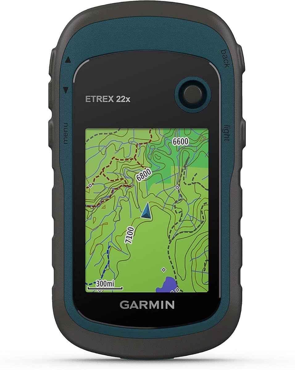
The Garmin eTrex 22x is a practical first off-road GPS, combining a 4.3 rating with a rugged, portable design. Its 2.2-inch sunlight-readable color display runs at 240 by 320 pixels, offering enough definition for basic trail following without the bulk of a vehicle-mounted touchscreen. It is the most budget-conscious option in this roundup and works well for riders who want dependable positioning without a large installation.
We may earn a commission when you buy through this link, at no additional cost to you.
Topo Active maps with routable roads and trails are preloaded, and support for both GPS and GLONASS satellite systems can improve tracking in challenging surroundings. Internal memory provides 8 GB for map downloads, while a microSD card slot expands storage. Two AA batteries deliver up to 25 hours in GPS mode, a major convenience for long trail days and remote trips where charging opportunities are limited.
The limitations are straightforward. A 2.2-inch display is less comfortable for complex route review, and the handheld form does not provide the instant visibility of a dashboard-mounted powersport navigator. It also lacks the electronic compass and barometric altimeter found in the eTrex 32x. If using it on an ATV, a secureRAM mount or equivalent holder is advisable so the unit does not fall or become a distraction.
This is a strong choice for beginners, solo riders, and anyone who values battery endurance and portability. It is also useful as a backup navigator that can be taken out of the vehicle without leaving the main GPS installed. Riders seeking easier glanceable navigation should consider a six-inch Tread, while the eTrex 22x remains the straightforward value option.
Using GPS and GLONASS together can help maintain a stable position where a single satellite system may be challenged. The benefit is most useful beneath heavy tree cover, near steep terrain, or in remote areas with limited network assistance.
The included 8 GB of internal memory supports map downloads, and a microSD card adds further flexibility. Download the regions you expect to visit before leaving reliable Wi-Fi, since the preloaded map set may not cover every trail you need.
We may earn a commission when you buy through this link, at no additional cost to you.
The Garmin Tread 2 SxS Edition is designed for riders who want a command-center view of the trail network. Its 4.7 rating reflects a strong overall package, while the 8-inch display provides unusually clear mapping for a powersport navigator. Rugged construction, an IP67 dust-and-water rating, and support for extreme temperatures make it especially appropriate for side-by-side adventures.
We may earn a commission when you buy through this link, at no additional cost to you.
The mapping suite is one of its strongest arguments. It combines OpenStreetMap, Forest Service Motor Vehicle Use Maps, Adventure Roads and Trails, and high-definition elevation details. Public and private land information, snow trails, campgrounds, and a directory of more than 46,000 public camping locations support both route planning and stops along the way. Satellite imagery downloads without a subscription, although downloading it still requires Wi-Fi.
The display size can work against the device on a small ATV. Riders should measure their available handlebar or dash space before choosing it, and they should confirm that the supplied tube mount will fit their vehicle. Live rider positions and uploaded great-rides content rely on smartphones, Bluetooth, and cellular service, so those features should not be treated as substitutes for a dedicated radio.
Overall, this unit is ideal for large side-by-sides, long-distance trail travel, and groups that value detailed overview. The expansive screen makes route selection and terrain review easier, while the supplied mount and wiring support permanent installation. Riders with smaller ATVs or a preference for a more compact cockpit should compare it closely with the six-inch Tread 2.
The extensive campground directory helps riders identify potential stops before setting out. Because availability and access can change, confirm local conditions and regulations, and treat the directory as a planning resource rather than a guarantee of an open site.
Satellite imagery can reveal terrain and route context that a standard road map may not show. Download the relevant areas while connected to Wi-Fi so the imagery remains available in areas without a cellular connection.
We may earn a commission when you buy through this link, at no additional cost to you.
The Garmin eTrex 32x upgrades the basic eTrex experience with a three-axis compass and barometric altimeter, making it a strong choice for riders who want more orientation data in a compact handheld unit. It has a 4.2 rating and shares a rugged 2.2-inch color display with the eTrex 22x, along with sunlight readability and 240-by-320 resolution.
We may earn a commission when you buy through this link, at no additional cost to you.
Its additional sensors are meaningful in off-road settings. A compass is useful when visibility or terrain limits your view, while the barometric altimeter can support elevation awareness during a route. GPS and GLONASS support, 8 GB of internal memory, and a microSD card slot provide dependable positioning and expandable map storage. Up to 25 hours of GPS operation from two AA batteries makes it suitable for remote journeys.
The small display remains the main compromise. Detailed trail maps can feel cramped, especially for riders trying to identify junctions or nearby services while moving. This is a portable navigation device rather than a dashboard unit, so secure mounting and a visible position in the line of sight are important. It also does not include the radio and group-position features of a dedicated Tread powersport system.
Buy the eTrex 32x if you prefer a lighter, battery-powered unit and value a compass and altimeter in a compact form. It is a particularly logical choice for backpack navigation, trail scouting, or a secondary GPS. The eTrex 22x remains the simpler budget model, while the 32x is the better-equipped handheld option.
The three-axis compass gives useful direction information when surrounding ridges, trees, or dust reduce visibility. Keeping the unit level helps it provide a more stable reading, which is why a secure mount is preferable during active trail travel.
The barometric altimeter adds elevation context without converting the device into a full powersport console. Combined with topographic maps, it helps riders understand where they are on climbs, descents, and elevated ridgelines.
We may earn a commission when you buy through this link, at no additional cost to you.
The Garmin zūmo XT3 is a compact, rugged navigator built for performance-minded motorcycle riders, and its features can translate well to ATVs used on a mix of highways, access roads, and trails. It carries a 4.2 rating and offers a 4.7-inch high-definition display in a housing designed to tolerate vibration, harsh weather, and rough conditions.
We may earn a commission when you buy through this link, at no additional cost to you.
Detailed street maps and high-definition topographic maps support mixed-surface travel, and satellite imagery can be downloaded directly to the unit. The visual route planner, Adventurous Routing settings, popular moto paths, and Michelin scenic routes are especially useful for riders who enjoy exploring paved roads between trail areas. Its live lean-angle gauge and Tread app ride summaries add a performance side that most conventional GPS units lack.
Although it is rugged, this is primarily a motorcycle navigator rather than a dedicated powersport trail computer. It lacks the extensive public-land, campground, and Motor Vehicle Use Map emphasis found in the Tread 2 SxS Edition. Group positions require the Tread app and cellular service, while performance and premium map features can involve additional plans.
The zūmo XT3 is a compelling choice for ATV riders whose routes include substantial highway travel or who value ride metrics and compact controls. Its 4.7-inch display is easier to accommodate than the six- or eight-inch Tread alternatives. For serious off-road mapping, however, a Tread model offers a more specialized feature set.
Adventurous Routing prioritizes curves, hills, and scenic roads, making the XT3 useful for exploration rather than only point-to-point travel. Riders can adjust difficulty and build routes on the device or in the Tread app.
The app can present ride summaries containing G-force, maximum speed, acceleration, and deceleration data. These metrics add value for solo riders assessing their own performance or groups comparing runs over the same route.
We may earn a commission when you buy through this link, at no additional cost to you.
The Garmin zūmo XT2 is a renewed, 6-inch all-terrain motorcycle navigator that emphasizes route planning, readability, and connected ride features. Its 4.0 rating is the lowest among the products reviewed, but the underlying specification set is substantial. The sunlight-readable display is large enough to support glanceable navigation while remaining more compact than the 8-inch Tread 2 SxS Edition.
We may earn a commission when you buy through this link, at no additional cost to you.
The visual route planner lets riders choose efficient routes or more adventurous alternatives, while popular moto paths and satellite imagery help reveal new riding locations. Group rides can display the positions of other participants, and the Tread app provides ride details such as speed, elevation, acceleration, and deceleration. Compatible headsets support spoken navigation, music, and hands-free calls when the necessary app and accessories are available.
The renewed status deserves careful attention. Inspect the condition description, confirm that the display, controls, mount, and power components are included, and review the seller's return terms. A compatible inReach device, Group Ride Radio, backup camera, or PowerSwitch expands functionality, but these are separate purchases and some communications features require active services.
This XT2 is well suited to ATV riders who want a large display, flexible route planning, and smartphone-assisted ride analysis. It is less explicitly trail-focused than the Tread 2 family and lacks the 2x's integrated radio arrangement. If a large all-terrain map screen matters most, the renewed XT2 presents a capable option with a more compact footprint than an eight-inch unit.
The visual route planner is useful when a point-to-point suggestion does not match the terrain you want to explore. Riders can create and edit routes on the device or through the Tread app, then use popular moto paths to discover established local lines.
Ride summaries turn a completed outing into useful performance information. Speed, elevation, acceleration, and deceleration records can help riders understand their pacing and compare repeated routes without replacing a dedicated track-day timing system.
We may earn a commission when you buy through this link, at no additional cost to you.
The Garmin Tread 2 offers the most balanced combination of screen size and dedicated powersport functionality in this guide. It has a 4.2 rating, a rugged 6-inch glove-friendly touchscreen, and an IP67 water rating for protection in changing outdoor conditions. Compared with the 8-inch SxS Edition, it is easier to accommodate on a wider range of ATVs without giving up much of the route detail.
We may earn a commission when you buy through this link, at no additional cost to you.
OpenStreetMap, Forest Service Motor Vehicle Use Maps, and Adventure Roads and Trails content support turn-by-turn navigation on unpaved routes. High-definition elevation maps, private and public land details, campgrounds, snow trails, and City Navigator maps allow riders to mix trail travel with paved connections. Subscription-free satellite imagery can be downloaded over Wi-Fi, and snowmobile-accessible services are included in selected areas of the United States and Canadian provinces.
Several advanced capabilities are optional. Outdoor Maps+ adds premium layers such as slope angle, slope aspect, and avalanche-risk reporting, while live group-location tracking requires active cellular service, Bluetooth-enabled phones, and the Tread app. The included roll-tube and handlebar mounting options help with installation, but riders should verify fit, cable routing, and visibility before beginning a trip.
The Tread 2 is the best recommendation for most ATV riders who want a serious off-road navigator without the footprint of an 8-inch display. It suits mixed terrain, long trail weekends, and riders who need both trail and road mapping. Riders seeking group radio communication should step up to the Tread Powersport, while those who want the largest possible map view can consider the SxS Edition.
Rugged roll-tube and handlebar mount choices provide a useful starting point for installation on different powersport vehicles. Position the display where it is visible without blocking controls, and route the power cable away from sharp edges and moving components.
Supported snowmobile trail content includes accessible fuel stops, warming shelters, and restaurants in selected regions. Availability varies by area, so riders should download the relevant maps and confirm seasonal access before setting out.
We may earn a commission when you buy through this link, at no additional cost to you.
The Garmin Tread Powersport is a complete navigation and communication platform for ATV groups, carrying a 4.4 rating. Its 5.5-inch glove-friendly touchscreen is large enough for a clear map overview but more manageable than the 6- and 8-inch alternatives. A rugged, IPX7 enclosure and included powered mounting hardware suit installation on compatible powersport vehicles.
We may earn a commission when you buy through this link, at no additional cost to you.
Its defining feature is the Group Ride Radio with push-to-talk fist microphone. Compatible Tread navigators can track the positions of up to 20 riders, making it easier to maintain awareness in a large group. Preloaded North American topographic and street maps include public-land boundaries, Forest Service roads, Motor Vehicle Use Maps, and downloadable BirdsEye Satellite Imagery, giving riders both route and landscape context.
Smartphone pairing expands planning and information through the Tread app. Waypoints, tracks, and routes can synchronize between devices, while GPX import and export supports route sharing. Live weather and optional inReach satellite communication require appropriate connectivity and services, and laws governing satellite devices vary by jurisdiction. The included powered mount and wiring harness simplify installation but should still be installed away from heat, water, and moving vehicle parts.
This standard Tread Powersport is an excellent choice for groups that want radio communication without moving to the larger Tread 2 platform. It balances usable screen size, off-road maps, and dependable group features. Riders heading into very remote areas may want to evaluate optional satellite communication, while solo riders can focus on the navigation and mapping strengths.
Shared location tracking helps riders see when the group stretches out, which is particularly useful around unfamiliar junctions and long trail sections. A radio call can provide the immediate explanation and instruction that a position marker alone cannot.
The Tread app supports route, track, and waypoint syncing, as well as GPX transfer, so planning can happen away from the ATV. Downloaded maps and imagery remain useful when cellular coverage disappears, but riders should complete those transfers while connected.
We may earn a commission when you buy through this link, at no additional cost to you.
The Garmin zūmo XT3 4.7-inch bundle combines a compact motorcycle navigator with several supporting accessories, giving it a 5.0 rating and making it a convenient one-stop package for new riders. The bundle includes a USB wall charger, USB Type-A to Type-C cable, portable battery, two-port USB car adapter, 32 GB memory card, and LCD cleaning kit.
We may earn a commission when you buy through this link, at no additional cost to you.
The navigator itself has a bright 4.7-inch display, IPX7 water resistance, and MIL-STD-810 durability. Detailed street maps, topographic maps, and downloadable satellite imagery support both road and trail travel. Adventurous Routing can favor curves, hills, and scenic roads with adjustable difficulty, while the Tread app handles custom planning, GPX, KML, and KMZ imports, group tracking, traffic, weather, and notifications.
Performance tools include lean angle, G-force, maximum speed, acceleration, and deceleration. Drag-race timing and lap review require an active Garmin Performance Package. The accessory bundle is convenient, but buyers should still assess whether every included item has value for their setup. A memory card is useful for downloaded maps, while the car adapter and portable battery can be helpful on long outings.
This bundle is a good choice for riders who want a compact 4.7-inch GPS, useful mobile planning, and several supporting accessories without sourcing them separately. It is especially appealing for touring and mixed-surface ATV rides. Riders whose priority is dense off-road mapping and public-land detail should choose a Tread 2 instead, while performance-focused riders may appreciate the XT3's ride metrics.
Support for GPX, KML, and KMZ files makes it easier to bring routes from different sources onto the navigator. The included 32 GB card provides additional storage for downloaded maps and media, although map availability should be checked before travel.
Lean-angle and G-force readings provide insight into cornering and body position, while speed, acceleration, and deceleration data help riders review each outing. Optional performance features add track-focused timing for riders who regularly visit closed courses or controlled tracks.
We may earn a commission when you buy through this link, at no additional cost to you.
Choosing an ATV GPS means balancing trail detail, screen readability, ruggedness, mounting, power, and the navigation features you will actually use. The right device depends on whether you ride solo, carry a map in a pack, travel with a group, or need a permanently mounted powersport console.
Handheld units such as the eTrex 22x and eTrex 32x are compact, battery-efficient, and easy to carry into the field. They are particularly useful for trail scouting, navigating on foot, or maintaining a backup away from the ATV. Their smaller screens can be less convenient for reading a complicated junction or trail network at speed. Vehicle-mounted Tread and zūmo units use larger touchscreens and are better suited to riders who want a permanent dashboard view, route following without repeatedly removing a device, and direct access to road-oriented navigation.
A sunlight-readable display is essential for open trails, while a glove-friendly touchscreen helps riders control the unit without removing gloves. The eTrex screens measure 2.2 inches and suit basic map reading, but larger displays are easier to interpret at speed. The zūmo XT3 sits in the middle at 4.7 inches, the Tread Powersport and zūmo XT2 offer 5.5- and 6-inch screens, and the Tread 2 SxS Edition reaches 8 inches. More screen space helps with junctions and terrain, but it also requires more handlebar or dashboard room.
A useful ATV GPS should do more than display paved roads. Look for topographic maps, public and private land information, Motor Vehicle Use Maps, and content for unpaved roads and trails. The Tread 2 family supports OpenStreetMap, Forest Service Motor Vehicle Use Maps, and Adventure Roads and Trails, while the eTrex models include Topo Active mapping. Downloaded satellite imagery is another valuable layer, especially for understanding clearings, branching paths, and remote terrain. Map suggestions remain subject to local restrictions, closures, and posted signs.
ATV navigation equipment is exposed to vibration, dust, rain, temperature swings, and repeated jolts. The Tread and zūmo families carry IPX7 or IP67 ratings, and the listed zūmo XT3 bundle also cites MIL-STD-810 durability. A weather-resistant rating does not mean the device should be deliberately submerged or left exposed to severe impacts, so a protective case and careful mounting remain sensible. Handheld eTrex units are rugged by design but need an appropriate RAM mount to prevent them from shifting around an ATV.
The included mount can determine how easily a navigator integrates with an ATV. The Tread 2 SxS Edition and Tread Powersport include tube-mounting hardware, while the standard Tread 2 offers roll-tube and handlebar options. A good installation should keep the screen readable without blocking handlebars, switches, the shift lever, or the rider's body. Secure the power cable away from sharp edges, hot components, and moving parts, and allow enough slack for steering and suspension movement. Riders should verify that the chosen mount matches the ATV's roll cage or handlebar geometry.
Battery strategy depends on whether the unit lives in the vehicle or accompanies the rider away from it. The eTrex 22x and 32x run up to 25 hours in GPS mode on two AA batteries, making them dependable for remote travel. Vehicle-mounted Tread and zūmo devices require a wired power connection, and the Tread 2 SxS Edition includes a bare-wire power cable. Riders should confirm the electrical connection, fuse requirements, and switch position for their ATV before installation, especially if they plan to use the navigator across multiple vehicles.
Riders who frequently travel in groups can benefit from position tracking, push-to-talk radio communication, and synchronized waypoints. The Tread Powersport includes a Group Ride Radio and supports tracking for up to 20 compatible Tread navigators, while the Tread 2 supports live positions through the Tread app. Smartphone-based tracking requires active cellular service and Bluetooth, and radio range changes with terrain. Dedicated radio communication may be more useful in heavily wooded or remote areas, although neither radio nor cellular tracking replaces careful group discipline and a planned rendezvous.
A compass, altimeter, barometer, gyroscope, and pitch-and-roll gauges can improve orientation and terrain awareness. The eTrex 32x adds a three-axis compass and barometric altimeter to its compact design, while the Tread models include more extensive motion sensing. The zūmo XT3 adds a live lean-angle gauge and records G-force, maximum speed, acceleration, and deceleration. These features are useful for mixed-terrain riding and post-ride review, but they should complement—not replace—careful observation, local trail knowledge, and legal navigation practices.
Begin by checking the unit's map coverage, downloading the regions and satellite imagery you expect to need, and confirming that routes account for local access rules, seasonal closures, fuel availability, and trail conditions. Create a backup route, identify key junctions and safe stopping points, and save offline copies of essential maps. Before a long trip, verify the screen is visible from a seated position and that the mount cannot rotate or fall into the rider's operating area.
Install a wired device according to the vehicle manufacturer's instructions, using the supplied power and mounting components where compatible. Route cables away from heat, sharp edges, suspension travel, and steering components, and avoid placing the unit where it could interfere with controls. Handheld units need a positive retention mechanism, and the screen should be allowed to reach a readable angle without forcing you to look away from the trail for long periods.
During use, follow the unit's instructions while also obeying posted signs, boundaries, and local regulations. Download maps before leaving Wi-Fi, carry an appropriate backup navigation method, and check the device's power level before departure. Clean the screen and housing with a soft, nonabrasive cloth, keep ports and connectors dry, and inspect mounts and cables periodically for looseness, damage, or excessive vibration.
Yes, a rugged motorcycle GPS can work well on an ATV, especially when the routes include paved roads, gravel connectors, and maintained trails. A dedicated powersport model may provide more direct trail mapping, public-land information, roll-tube mounting, and vehicle-oriented power options. Make sure the display can be mounted securely and remains readable without blocking the handlebars or controls.
A 4.7- to 6-inch screen is a practical compromise between map detail and dashboard space for many ATVs. An 8-inch display is easier to read but may crowd smaller vehicles or interfere with the rider's controls. A 2.2-inch handheld screen is more portable and economical, though detailed junction review can be less comfortable at speed.
Satellite imagery is helpful but not essential for every trail. It can reveal clearings, route patterns, and terrain features that are difficult to interpret on a standard map. The Garmin devices in this guide can download imagery over Wi-Fi without requiring a continuing subscription, although users should download relevant regions before entering areas without connectivity.
Yes. Core navigation on these Garmin devices relies on satellite positioning and locally stored map data, so cellular service is not generally required for turn-by-turn guidance. Smartphone-paired functions such as live group tracking, traffic, weather, and some shared content may need an active connection, while compatible inReach satellite communicators require a separate device and service.
Handhelds excel when portability, low weight, and long AA battery life matter most. They can also be taken out of the ATV and used for scouting on foot. Mounted units provide a larger screen, continuous visibility, and easier access to vehicle-specific mapping, making them generally more convenient when following a route during the ride itself.
They are helpful but not mandatory for every rider. A compass maintains directional awareness when you cannot clearly see a landmark, while an altimeter adds elevation information that complements topographic maps. The eTrex 32x includes both, making it a well-equipped handheld option, while the Tread 2 models add a broader set of terrain and motion sensors.
It depends on the tracking method. App-based live locations require cellular service, while a dedicated Group Ride Radio on compatible Tread Powersport systems provides direct communication without depending on the same cellular network. Radio range can still be reduced by hills and dense vegetation, so groups should establish meeting procedures and remain within practical communication limits.
Download the full map region and any desired satellite imagery before leaving reliable Wi-Fi, then test the route in an area where you can stop safely. Save important waypoints, identify fuel and campground options, and bring a separate backup for emergencies. Always follow posted signs and current land-access rules, because a mapped route does not guarantee that the trail is open or legal.
The Garmin Tread 2 SxS Edition is the strongest all-around choice for riders with adequate cockpit space because its 8-inch display, detailed trail mapping, downloadable satellite imagery, campground information, and dedicated powersport mounting create the most complete off-road package. The Tread 2 delivers many of the same strengths in a more manageable 6-inch format, making it the best balanced recommendation for many ATVs.
Prioritize the features that match your riding style. Choose the eTrex 22x for an economical, portable navigator with long battery life; consider the eTrex 32x when compass and altitude features are important; select the Tread Powersport when direct radio communication is essential; and evaluate the zūmo XT3 when ride metrics, lean-angle data, and mixed road exploration matter most. Above all, confirm screen size, mounting compatibility, map coverage, and power before purchasing.
Configurations, bundle contents, and availability can change, and current offers should be checked directly with the retailer. Review the final product listing carefully, confirm that the required mounting or power components are included, and download the maps relevant to your next trip before leaving coverage.